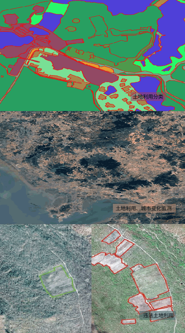
Land mapping and natural resource services
Overcoming the high investment, long cycle, and low efficiency characteristics of traditional survey methods, fully utilizing the high-precision, multi temporal, and wide-area coverage characteristics of remote sensing technology, periodic monitoring of land use types, areas, changes, vegetation growth, and other factors plays an important role in natural resources, agriculture, and forestry.